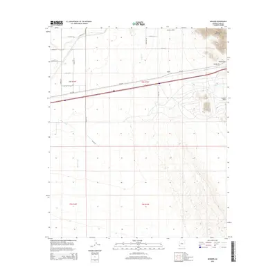
2014 Map of Mohawk
USGS Topo · Published 2014About this map
Mohawk sits along the southern edge of the Mohawk Valley in this desert corridor of Yuma County. The settlement and the surrounding terrain are defined by the passage between the Mohawk Mountains and the arid lowlands, centered on the historic route of Old US-80. The landscape is etched by seasonal drainage systems, including the prominent Mohawk Wash and Owl Wash, which flow from the high ground toward the valley floor. To the northeast, Mohawk Pass serves as a critical natural gateway through the mountain range, influencing the placement of early transportation infrastructure. The map also identifies the locality of Owl, situated just north of the highway. This survey illustrates the relationship between the narrow mountain gaps and the development of travel routes through the southwestern Arizona desert.
Find a feature on this map
21 named features on this map. Tap any name to fly to it.
Don’t see what you’re looking for? This feature index may not catch every label — zoom into the map to look around manually.
Map Details
Editions of this 2014 Mohawk Map
This is the sole edition of this map. No revisions or reprints were ever made.
Other maps of this area

1926 · Mohawk
USGS Topo · 1:62,500

1927 · Kim
USGS Topo · 1:62,500

1928 · Mohawk
USGS Topo · 1:62,500

1928 · Norton
USGS Topo · 1:62,500

1929 · Norton
USGS Topo · 1:62,500

1930 · Stoval
USGS Topo · 1:62,500

1931 · Kim
USGS Topo · 1:62,500

1950 · Stoval
USGS Topo · 1:62,500

1953 · Ajo
USGS Topo · 1:250,000

1955 · Growler
USGS Topo · 1:24,000