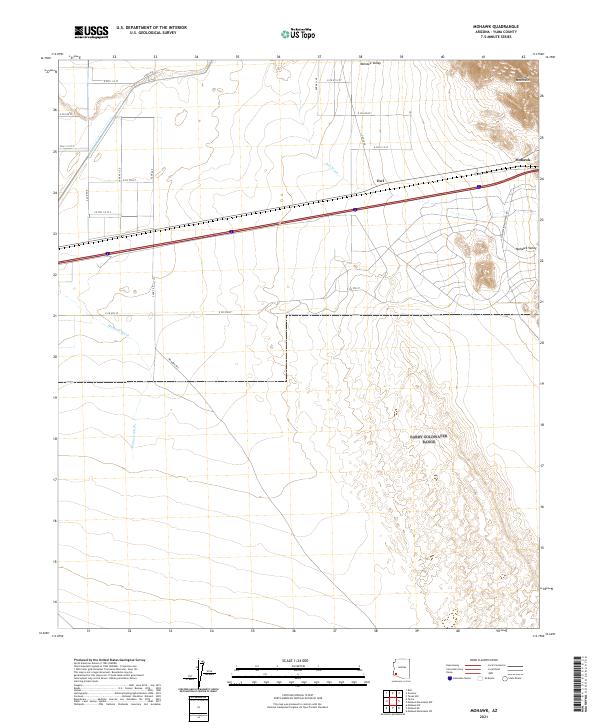
2021 Map of Mohawk
USGS Topo · Published 2021About this map
Mohawk Valley and the northern slopes of the Mohawk Mountains define the arid landscape of this Yuma County quadrangle. The settlement of Mohawk sits along a primary transportation corridor, mirrored to the west by the smaller locale of Owl. This area is characterized by vast drainage patterns, including the prominent Owl Wash and Mohawk Wash, which channel seasonal water across the desert floor toward the valley. The map reveals a structured grid of rural roads, such as E Co 6th St and S Ave 46 E, alongside specialized routes like the Mohawk Papago Well Rd. This infrastructure indicates the sparse but deliberate human imprint on the high desert, focused around water access points and the established transit lines that cross the basin.
Find a feature on this map
24 named features on this map. Tap any name to fly to it.
Don’t see what you’re looking for? This feature index may not catch every label — zoom into the map to look around manually.
Map Details
Editions of this 2021 Mohawk Map
This is the sole edition of this map. No revisions or reprints were ever made.
Other maps of this area

1926 · Mohawk
USGS Topo · 1:62,500

1927 · Kim
USGS Topo · 1:62,500

1928 · Mohawk
USGS Topo · 1:62,500

1928 · Norton
USGS Topo · 1:62,500

1929 · Norton
USGS Topo · 1:62,500

1930 · Stoval
USGS Topo · 1:62,500

1931 · Kim
USGS Topo · 1:62,500

1950 · Stoval
USGS Topo · 1:62,500

1953 · Ajo
USGS Topo · 1:250,000

1955 · Growler
USGS Topo · 1:24,000