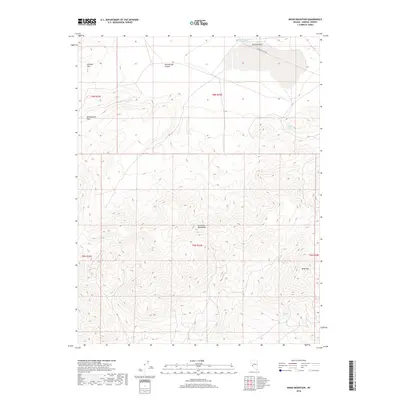
2018 Map of Moho Mountain
USGS Topo · Published 2018About this map
The Excelsior Mountains dominate this high-desert terrain of Mineral County, with the prominent peak of Moho Mtn rising in the southeast. This modern survey illustrates a landscape defined by significant elevation changes and scarce water sources, where names like Garfield Spring and Belleville Springs indicate the vital natural seeps that once supported travelers and livestock in the Great Basin. To the north, the Garfield Hills transition into the level expanse of Garfield Flat, which is traversed by Garfield Flat Rd. The presence of the Garfield Reservoir Number Two suggests managed water resources in an otherwise arid environment. Along the western edge, the topography descends through Rattlesnake Canyon toward Rattlesnake Flat, revealing the complex drainage patterns of this Nevada range.
Find a feature on this map
15 named features on this map. Tap any name to fly to it.
Don’t see what you’re looking for? This feature index may not catch every label — zoom into the map to look around manually.
Map Details
Editions of this 2018 Moho Mountain Map
This is the sole edition of this map. No revisions or reprints were ever made.
Other maps of this area

1909 · Hawthorne
USGS Topo · 1:250,000

1911 · Hawthorne
USGS Topo · 1:250,000

1915 · Hawthorne
USGS Topo · 1:250,000

1948 · Walker Lake
USGS Topo · 1:250,000

1957 · Walker Lake
USGS Topo · 1:250,000

1962 · Walker Lake
USGS Topo · 1:250,000

1964 · Walker Lake
USGS Topo · 1:250,000

1967 · Pamlico
USGS Topo · 1:24,000

1967 · Moho Mountain
USGS Topo · 1:24,000

1967 · Mina NW
USGS Topo · 1:24,000