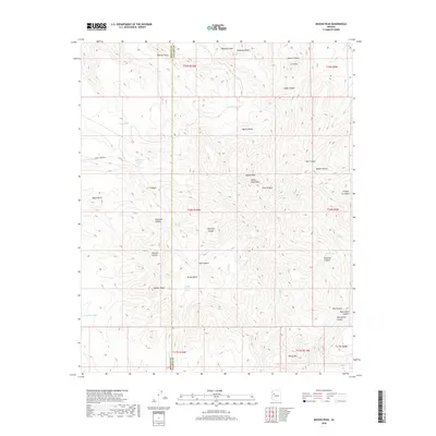
2018 Map of Mohon Peak
USGS Topo · Published 2018About this map
Mohon Peak and the Mohon Mountains dominate the high-elevation divide along the border of Mohave and Yavapai Counties. This arid landscape is defined by its verticality and critical water points, where names like Stevens Spring, Rock Tank, and Goldwater Tank indicate the vital importance of moisture in the high desert. The terrain is deeply dissected by drainage systems including Gonzales Canyon, Winslow Canyon, and Moffit Canyon, which cut through the uplifted peaks. Cattle ranching and land management are evident through named infrastructure such as Boulder Tank and Brushy Basin Spring, reflecting a long history of human adaptation to these remote highlands. Further south, Walker Peak and Denny Mtn provide additional landmarks in a territory largely defined by its natural drainage patterns like Hop Cr and Willow Cr.
Find a feature on this map
47 named features on this map. Tap any name to fly to it.
Don’t see what you’re looking for? This feature index may not catch every label — zoom into the map to look around manually.
Map Details
Editions of this 2018 Mohon Peak Map
This is the sole edition of this map. No revisions or reprints were ever made.
Other maps of this area

1886 · Diamond Creek
USGS Topo · 1:250,000

1892 · Diamond Creek
USGS Topo · 1:250,000

1923 · Signal
USGS Topo · 1:250,000

1942 · Signal
USGS Topo · 1:250,000

1948 · Williams
USGS Topo · 1:250,000

1950 · Prescott
USGS Topo · 1:250,000

1954 · Prescott
USGS Topo · 1:250,000

1954 · Williams
USGS Topo · 1:250,000

1956 · Williams
USGS Topo · 1:250,000

1958 · Prescott
USGS Topo · 1:250,000