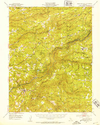
1948 Map of Mokelumne Hill
USGS Topo · Published 1953About this map
Mokelumne Hill stands as the historic focal point of this Mother Lode landscape, situated just south of the Mokelumne River as it divides Amador and Calaveras Counties. The 1948 survey reflects a transitional era for the region, balancing its gold-mining heritage with newer infrastructure. Large-scale water and power management is evident at the Electra Powerhouse and Lake Tabeaud, while the Mother Lode Airport signals the mid-century modernization of transport.
Find a feature on this map
83 named features on this map. Tap any name to fly to it.
Don’t see what you’re looking for? This feature index may not catch every label — zoom into the map to look around manually.
Map Details
Editions of this 1948 Mokelumne Hill Map
3 editions found
Other maps of this area

1889 · Jackson
USGS Topo · 1:125,000

1889 · Pyramid Peak
USGS Topo · 1:125,000

1891 · Big Trees
USGS Topo · 1:125,000

1891 · Placerville
USGS Topo · 1:125,000

1891 · Pyramid Peak
USGS Topo · 1:125,000

1892 · Jackson
USGS Topo · 1:125,000

1892 · Placerville
USGS Topo · 1:125,000

1893 · Placerville
USGS Topo · 1:125,000

1894 · Big Trees
USGS Topo · 1:125,000

1895 · Pyramid Peak
USGS Topo · 1:125,000