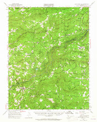
1948 Map of Mokelumne Hill
USGS Topo · Published 1965About this map
Gold Country history is etched across the landscape of this 1948 survey, where the Mokelumne River and its various forks carve through the Mother Lode region. Mining remains a visible legacy of the area's development, evidenced by the Barkley Mine, Wolverine Mine, and the Fort Ann Mine. The map highlights the evolution of transit and infrastructure, from the Mother Lode Airport to the complex water engineering of the Electra Tunnel and Tiger Creek Spillway Canal.
Find a feature on this map
94 named features on this map. Tap any name to fly to it.
Don’t see what you’re looking for? This feature index may not catch every label — zoom into the map to look around manually.
Map Details
Editions of this 1948 Mokelumne Hill Map
3 editions found
Other maps of this area

1889 · Jackson
USGS Topo · 1:125,000

1889 · Pyramid Peak
USGS Topo · 1:125,000

1891 · Big Trees
USGS Topo · 1:125,000

1891 · Placerville
USGS Topo · 1:125,000

1891 · Pyramid Peak
USGS Topo · 1:125,000

1892 · Jackson
USGS Topo · 1:125,000

1892 · Placerville
USGS Topo · 1:125,000

1893 · Placerville
USGS Topo · 1:125,000

1894 · Big Trees
USGS Topo · 1:125,000

1895 · Pyramid Peak
USGS Topo · 1:125,000