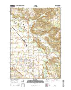
2014 Map of Molalla
USGS Topo · Published 2014About this map
The Molalla township serves as a central hub in this Clackamas County landscape, where the Molalla River winds northward through a patchwork of agricultural and residential land. The river is a focal point for recreation and infrastructure, featuring several crossings such as Wrights Bridge and Dickey Bridge, along with public access points like the Wagon Wheel Park Boat Ramp and Feyrer Park Boat Ramp. The town itself is home to the Molalla Buckeroo Rodeo Grounds, signaling the area's deep-rooted equestrian and ranching traditions.
Find a feature on this map
128 named features on this map. Tap any name to fly to it.
Don’t see what you’re looking for? This feature index may not catch every label — zoom into the map to look around manually.
Map Details
Editions of this 2014 Molalla Map
This is the sole edition of this map. No revisions or reprints were ever made.
Other maps of this area

1911 · Boring
USGS Topo · 1:48,000

1914 · Boring
USGS Topo · 1:62,500

1914 · Oregon City
USGS Topo · 1:62,500

1916 · Estacada
USGS Topo · 1:125,000

1939 · Molalla
USGS Topo · 1:62,500

1939 · Oregon City
USGS Topo · 1:62,500

1940 · Molalla
USGS Topo · 1:62,500

1940 · Boring
USGS Topo · 1:62,500

1941 · Oregon City
USGS Topo · 1:62,500

1948 · Vancouver
USGS Topo · 1:250,000