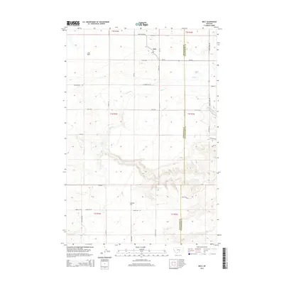
2014 Map of Molt
USGS Topo · Published 2014About this map
Molt serves as the primary hub in this corner of the Montana plains, where the boundary between Stillwater and Yellowstone Counties bisects the rural landscape. This modern survey illustrates the persistent ranching and agricultural patterns of the Big Sky region, defined by a network of named tracks like Buffalo Trail RD and Molt-Rapelje RD. The terrain is shaped by the drainage systems of Canyon Creek and the North Fork Canyon Creek, which carve through the high plateaus. Strategic water sources, essential for survival in this arid environment, are clearly marked at Morgan Spring and Indian Spring. To the south, the expansive Coombs Flat dominates the topography, while the northern reaches include the prominent Lake Basin.
Find a feature on this map
35 named features on this map. Tap any name to fly to it.
Don’t see what you’re looking for? This feature index may not catch every label — zoom into the map to look around manually.
Map Details
Editions of this 2014 Molt Map
This is the sole edition of this map. No revisions or reprints were ever made.
Other maps of this area

1892 · Stillwater
USGS Topo · 1:125,000

1954 · Billings
USGS Topo · 1:250,000

1956 · Comanche
USGS Topo · 1:24,000

1956 · Hunter Lake
USGS Topo · 1:24,000

1956 · Horse Butte
USGS Topo · 1:24,000

1956 · Molt
USGS Topo · 1:24,000

1956 · Wheat Basin
USGS Topo · 1:24,000

1956 · Rock Spring
USGS Topo · 1:24,000

1956 · Two Pine School
USGS Topo · 1:24,000

1956 · Laurel
USGS Topo · 1:24,000