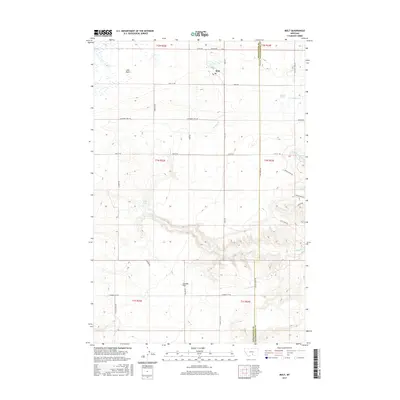
2017 Map of Molt
USGS Topo · Published 2017About this map
Molt serves as the primary settlement hub in this part of the Montana high plains, situated near the headwaters of Canyon Cr. The landscape is defined by broad geographic features like the Lake Basin to the northwest and the elevated expanse of Coombs Flat in the south. This 2017 survey reveals a highly organized grid of rural roads, including Columbus Molt Rd and Molt Rd, which facilitate transport across the ranching and agricultural lands of the Stillwater and Yellowstone county border. Water sources like Indian Spring and Morgan Spring are critical landmarks in this arid terrain, punctuating the drainages that feed into the larger coulee systems. The map illustrates how modern property boundaries and township lines, such as t1n r22e, remain fundamentally tied to the early land surveys that partitioned this territory.
Find a feature on this map
38 named features on this map. Tap any name to fly to it.
Don’t see what you’re looking for? This feature index may not catch every label — zoom into the map to look around manually.
Map Details
Editions of this 2017 Molt Map
This is the sole edition of this map. No revisions or reprints were ever made.
Other maps of this area

1892 · Stillwater
USGS Topo · 1:125,000

1954 · Billings
USGS Topo · 1:250,000

1956 · Comanche
USGS Topo · 1:24,000

1956 · Hunter Lake
USGS Topo · 1:24,000

1956 · Horse Butte
USGS Topo · 1:24,000

1956 · Molt
USGS Topo · 1:24,000

1956 · Wheat Basin
USGS Topo · 1:24,000

1956 · Rock Spring
USGS Topo · 1:24,000

1956 · Two Pine School
USGS Topo · 1:24,000

1956 · Laurel
USGS Topo · 1:24,000