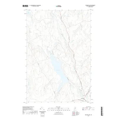
2021 Map of Molunkus Lake
USGS Topo · Published 2021About this map
Macwahoc serves as the focal point of human settlement in this Aroostook County landscape, situated at the junction of several key thoroughfares. The confluence of Molunkus Stream and Magurrewock Stream defines the southern portion of the quadrangle, where the Military Rd and Silver Ridge Rd meet. This area preserves local family history through the Smith Cem and Village Cem, which sit near the riverbanks.
Find a feature on this map
30 named features on this map. Tap any name to fly to it.
Don’t see what you’re looking for? This feature index may not catch every label — zoom into the map to look around manually.
Map Details
Editions of this 2021 Molunkus Lake Map
This is the sole edition of this map. No revisions or reprints were ever made.
Other maps of this area

1940 · Sherman
USGS Topo · 1:62,500

1940 · Mattawamkeag
USGS Topo · 1:62,500

1941 · Mattawamkeag Lake
USGS Topo · 1:62,500

1941 · Wytopitlock
USGS Topo · 1:62,500

1942 · Mattawamkeag
USGS Topo · 1:62,500

1942 · Sherman
USGS Topo · 1:62,500

1943 · Wytopitlock
USGS Topo · 1:62,500

1943 · Mattawamkeag Lake
USGS Topo · 1:62,500

1954 · Millinocket
USGS Topo · 1:250,000

1958 · Millinocket
USGS Topo · 1:250,000
Featured Places
- Macwahoc Plantation, ME
- Macwahoc, Macwahoc Plantation
- T1 R5 WELS, ME
- Upper Molunkus Township, ME
- North Yarmouth Academy Grant Township, ME