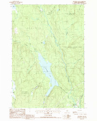
1988 Map of Molunkus Lake
USGS Topo · Published 1988About this map
Molunkus Lake and its surrounding timberlands dominate this portion of Aroostook County, as documented in the late 1980s. The landscape is defined by an extensive hydrological network, where Molunkus Stream flows south through township lands including Upper Molunkus and the North Yarmouth Academy Grant. Human activity is concentrated along the waterways and the Trans Maine Pipeline corridor that cuts across the southern terrain.
Find a feature on this map
29 named features on this map. Tap any name to fly to it.
Don’t see what you’re looking for? This feature index may not catch every label — zoom into the map to look around manually.
Map Details
Editions of this 1988 Molunkus Lake Map
This is the sole edition of this map. No revisions or reprints were ever made.
Other maps of this area

1940 · Sherman
USGS Topo · 1:62,500

1940 · Mattawamkeag
USGS Topo · 1:62,500

1941 · Mattawamkeag Lake
USGS Topo · 1:62,500

1941 · Wytopitlock
USGS Topo · 1:62,500

1942 · Mattawamkeag
USGS Topo · 1:62,500

1942 · Sherman
USGS Topo · 1:62,500

1943 · Wytopitlock
USGS Topo · 1:62,500

1943 · Mattawamkeag Lake
USGS Topo · 1:62,500

1954 · Millinocket
USGS Topo · 1:250,000

1958 · Millinocket
USGS Topo · 1:250,000
Featured Places
- Macwahoc, Macwahoc Plantation
- Macwahoc Plantation, ME
- T1 R5 WELS, ME
- Upper Molunkus Township, ME
- North Yarmouth Academy Grant Township, ME