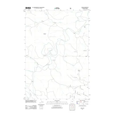
2012 Map of Mona
USGS Topo · Published 2012About this map
The Belle Fourche River winds through a landscape of high plains and scattered livestock operations in this northern section of Crook County. Ranching history is deeply etched into the topography, with established holdings like the Cross Anchor Ranch, Pannell Ranch, and Svoboda Ranch defining the local geography. The settlement of Mona sits near the eastern edge of the quadrangle, while the smaller locality of Terhune is positioned to the west along Deer Creek Rd. Significant landmarks such as Branaman Mountain and Buffalo Basin break the river valley, providing distinct navigational points for those tracing the agricultural development of the region. The map also documents an intricate system of rural access, including Mona Belle Rd and several timber-related routes like Bearlodge Br 5G, indicating the connection between the open range and the nearby forest lands.
Find a feature on this map
35 named features on this map. Tap any name to fly to it.
Don’t see what you’re looking for? This feature index may not catch every label — zoom into the map to look around manually.
Map Details
Editions of this 2012 Mona Map
This is the sole edition of this map. No revisions or reprints were ever made.
Other maps of this area

1901 · Aladdin
USGS Topo · 1:125,000

1903 · Aladdin
USGS Topo · 1:125,000

1905 · Devils Tower
USGS Topo · 1:125,000

1954 · Gillette
USGS Topo · 1:250,000

1955 · Devils Tower
USGS Topo · 1:62,500

1955 · Gillette
USGS Topo · 1:250,000

1957 · Mona
USGS Topo · 1:62,500

1957 · Seely
USGS Topo · 1:62,500

1958 · Gillette
USGS Topo · 1:250,000

1962 · Gillette
USGS Topo · 1:250,000