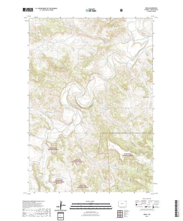
2021 Map of Mona
USGS Topo · Published 2021About this map
The Black Hills National Forest anchors the southern half of this landscape, where the northern reaches of the Bear Lodge Mountains rise above the drainage basins of Crook County. The Belle Fourche River winds through the central portion of the map, creating a complex series of bends and loops that define the local topography. This area is characterized by significant elevation changes, from the heights of Branaman Mtn to the low-lying Buffalo Basin and the incision of Sand Draw.
Find a feature on this map
22 named features on this map. Tap any name to fly to it.
Don’t see what you’re looking for? This feature index may not catch every label — zoom into the map to look around manually.
Map Details
Editions of this 2021 Mona Map
This is the sole edition of this map. No revisions or reprints were ever made.
Other maps of this area

1901 · Aladdin
USGS Topo · 1:125,000

1903 · Aladdin
USGS Topo · 1:125,000

1905 · Devils Tower
USGS Topo · 1:125,000

1954 · Gillette
USGS Topo · 1:250,000

1955 · Devils Tower
USGS Topo · 1:62,500

1955 · Gillette
USGS Topo · 1:250,000

1957 · Mona
USGS Topo · 1:62,500

1957 · Seely
USGS Topo · 1:62,500

1958 · Gillette
USGS Topo · 1:250,000

1962 · Gillette
USGS Topo · 1:250,000