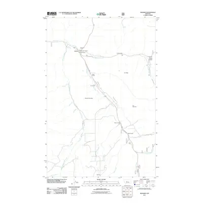
2011 Map of Monarch
USGS Topo · Published 2011About this map
Monarch sits at the confluence of several drainages in the Little Belt Mountains, where Belt Creek winds through the dramatic Monarch Canyon. The landscape is defined by its deep coulees and mountain peaks, with the settlement of Belt Park located to the south near the headwaters of Rafferty Creek. This 2011 survey documents a community tied to the land, featuring the Monarch Post Office and Monarch Vol Fire Dept as central landmarks.
Find a feature on this map
37 named features on this map. Tap any name to fly to it.
Don’t see what you’re looking for? This feature index may not catch every label — zoom into the map to look around manually.
Map Details
Editions of this 2011 Monarch Map
This is the sole edition of this map. No revisions or reprints were ever made.
Other maps of this area

1886 · Little Belt Mts.
USGS Topo · 1:250,000

1890 · Fort Benton
USGS Topo · 1:250,000

1892 · Fort Benton
USGS Topo · 1:250,000

1894 · Little Belt Mts.
USGS Topo · 1:250,000

1897 · Fort Benton
USGS Topo · 1:250,000

1897 · Little Belt Mts.
USGS Topo · 1:250,000

1898 · Little Belt Mts.
USGS Topo · 1:250,000

1902 · Little Belt Mts.
USGS Topo · 1:250,000

1948 · White Sulphur Springs
USGS Topo · 1:250,000

1954 · Great Falls
USGS Topo · 1:250,000