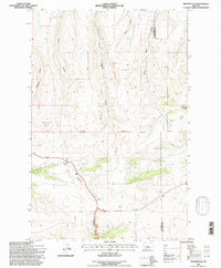
1995 Map of Monarch NE
USGS Topo · Published 1997About this map
Rattlesnake Butte anchors the western landscape of this mid-1990s U.S. Forest Service and Geological Survey revision. The terrain is defined by a dense network of drainages and coulees, including the prominently marked Monarch Canyon and Ford Coulee. This study captures the high-country character of the region as it transitions across the Cascade Co Judith Basin Co boundary.
Find a feature on this map
14 named features on this map. Tap any name to fly to it.
Don’t see what you’re looking for? This feature index may not catch every label — zoom into the map to look around manually.
Map Details
Editions of this 1995 Monarch NE Map
This is the sole edition of this map. No revisions or reprints were ever made.
Other maps of this area

1890 · Fort Benton
USGS Topo · 1:250,000

1892 · Fort Benton
USGS Topo · 1:250,000

1897 · Fort Benton
USGS Topo · 1:250,000

1954 · Great Falls
USGS Topo · 1:250,000

1956 · Belt
USGS Topo · 1:62,500

1957 · Great Falls
USGS Topo · 1:250,000
1961 · Limestone Butte
USGS Topo · 1:24,000
1961 · Barker
USGS Topo · 1:24,000

1961 · Barker
USGS Topo · 1:62,500
1967 · Monarch NE
USGS Topo · 1:24,000