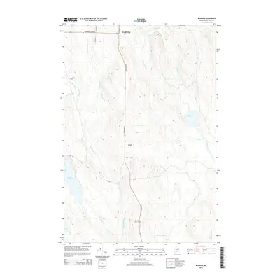
2014 Map of Monarda
USGS Topo · Published 2014About this map
Monarda and Silver Ridge sit at the center of this Aroostook County landscape, where the terrain is defined by a dense network of waterways feeding the Mattawamkeag River system. These small settlements are linked by Silver Ridge Rd, which runs north past Silver Ridge Cem toward Woodbridge Corner. The area is characterized by numerous water bodies, including Macwahoc Lake, Lower Macwahoc Lake, and the tucked-away Plunkett Pond. These basins and the surrounding marshes are drained by prominent channels like Macwahoc Stream and Molunkus Stream, creating a complex hydrographic pattern typical of Maine's northern woodlands. Genealogists and historians can trace the early road network, such as Pond Rd and Lake Rd, which historically connected isolated farmsteads and timber interests to these central crossroads.
Find a feature on this map
31 named features on this map. Tap any name to fly to it.
Don’t see what you’re looking for? This feature index may not catch every label — zoom into the map to look around manually.
Map Details
Editions of this 2014 Monarda Map
This is the sole edition of this map. No revisions or reprints were ever made.
Other maps of this area

1940 · Sherman
USGS Topo · 1:62,500

1940 · Mattawamkeag
USGS Topo · 1:62,500

1941 · Mattawamkeag Lake
USGS Topo · 1:62,500

1941 · Wytopitlock
USGS Topo · 1:62,500

1942 · Mattawamkeag
USGS Topo · 1:62,500

1942 · Sherman
USGS Topo · 1:62,500

1943 · Wytopitlock
USGS Topo · 1:62,500

1943 · Mattawamkeag Lake
USGS Topo · 1:62,500

1954 · Millinocket
USGS Topo · 1:250,000

1958 · Millinocket
USGS Topo · 1:250,000