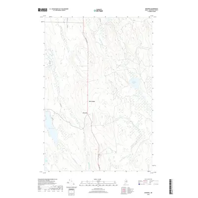
2018 Map of Monarda
USGS Topo · Published 2018About this map
Silver Ridge and Monarda anchor this topographical study of southern Aroostook County, where the landscape is defined by an intricate network of waterways and glacial depressions. The terrain is characterized by its numerous brooks and drainages, such as Molunkus Stream, Macwahoc Stream, and Saint John Brook, which thread between modest ridges. The central artery of Silver Ridge Rd connects these small settlements, passing by the Silver Ridge Cem, a key landmark for genealogical research in this sparsely populated township. To the east and west, the map reveals significant water bodies including Plunkett Pond, Flinn Pond, and Lower Macwahoc Lake, surrounded by expansive wetlands. The presence of roads like Thorn Rd and Extract Rd suggests a landscape shaped by local transit and the regional timber-and-water economy of northern Maine.
Find a feature on this map
26 named features on this map. Tap any name to fly to it.
Don’t see what you’re looking for? This feature index may not catch every label — zoom into the map to look around manually.
Map Details
Editions of this 2018 Monarda Map
This is the sole edition of this map. No revisions or reprints were ever made.
Other maps of this area

1940 · Sherman
USGS Topo · 1:62,500

1940 · Mattawamkeag
USGS Topo · 1:62,500

1941 · Mattawamkeag Lake
USGS Topo · 1:62,500

1941 · Wytopitlock
USGS Topo · 1:62,500

1942 · Mattawamkeag
USGS Topo · 1:62,500

1942 · Sherman
USGS Topo · 1:62,500

1943 · Wytopitlock
USGS Topo · 1:62,500

1943 · Mattawamkeag Lake
USGS Topo · 1:62,500

1954 · Millinocket
USGS Topo · 1:250,000

1958 · Millinocket
USGS Topo · 1:250,000