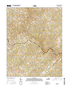
2016 Map of Moneta
USGS Topo · Published 2016About this map
Davis Mill and Moneta anchor this central Virginia landscape, where the waters of Goose Creek wind through a complex system of ridges and valleys. The area is characterized by several high points, most notably Stone Mtn, and named agricultural Clearings like Johnson Fox Field. Local genealogy is well-represented through the presence of several family and community burial grounds, including Bond Cem, Morgan Cem, and the Morgans Church Cem adjacent to Morgans Church.
Find a feature on this map
86 named features on this map. Tap any name to fly to it.
Don’t see what you’re looking for? This feature index may not catch every label — zoom into the map to look around manually.
Map Details
Editions of this 2016 Moneta Map
This is the sole edition of this map. No revisions or reprints were ever made.
Other maps of this area

1890 · Roanoke
USGS Topo · 1:125,000

1891 · Roanoke
USGS Topo · 1:125,000

1892 · Lynchburg
USGS Topo · 1:125,000

1947 · Roanoke
USGS Topo · 1:250,000

1950 · Goode
USGS Topo · 1:62,500

1950 · Peaks of Otter
USGS Topo · 1:62,500

1951 · Moneta
USGS Topo · 1:62,500

1951 · Altavista
USGS Topo · 1:62,500

1959 · Roanoke
USGS Topo · 1:250,000

1963 · Roanoke
USGS Topo · 1:250,000