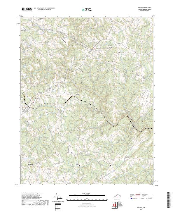
2022 Map of Moneta
USGS Topo · Published 2022About this map
Moneta and the surrounding Bedford County countryside are defined by a complex network of waterways feeding into the prominent Goose Creek. The landscape transitions from the higher elevations of Stone Mtn and Meadow Ridge toward the winding valleys of Rockcastle Cr and Body Camp Cr. This era shows a community anchored by legacy locations like Davis Mill and the settlement at Radford. Local history and genealogy are preserved through several family landmarks, including the Blankenship Family Cem, Bond Cem, and Morgan Cem. The terrain is marked by distinctive local features like the Dark Hollow depression and recreational spaces such as Johnson Fox Field. Modern infrastructure like Moneta RD and Stewartsville RD now follows the historical contours of the land, connecting these older rural sites.
Find a feature on this map
90 named features on this map. Tap any name to fly to it.
Don’t see what you’re looking for? This feature index may not catch every label — zoom into the map to look around manually.
Map Details
Editions of this 2022 Moneta Map
This is the sole edition of this map. No revisions or reprints were ever made.
Other maps of this area

1890 · Roanoke
USGS Topo · 1:125,000

1891 · Roanoke
USGS Topo · 1:125,000

1892 · Lynchburg
USGS Topo · 1:125,000

1947 · Roanoke
USGS Topo · 1:250,000

1950 · Goode
USGS Topo · 1:62,500

1950 · Peaks of Otter
USGS Topo · 1:62,500

1951 · Moneta
USGS Topo · 1:62,500

1951 · Altavista
USGS Topo · 1:62,500

1959 · Roanoke
USGS Topo · 1:250,000

1963 · Roanoke
USGS Topo · 1:250,000