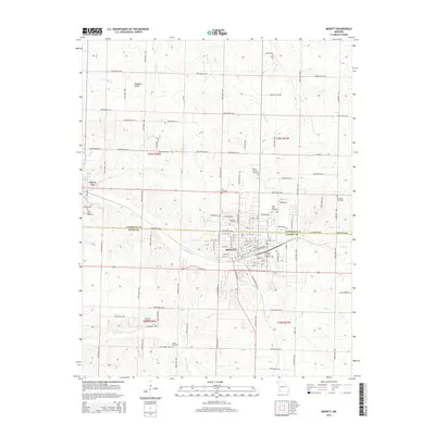
2015 Map of Monett
USGS Topo · Published 2015About this map
The boundary between Lawrence and Barry counties splits the city of Monett, a vital regional hub centered on its grid of streets such as 9th St and 13th St. This 2015 survey reveals a landscape where organized civic life is anchored by numerous burial grounds, including the centrally located Oakdale Cemetery and Mount Calvary Cemetery. To the west, Pierce City stands along the edge of the sheet, while the rural surroundings are dotted with smaller communities like Pleasant Valley and the settlement of Lora to the south. The terrain is defined by a dendritic network of waterways, with Clear Creek and Kelly Creek draining the plains around the urban center. These creeks, alongside Hudson Creek and Pruitt Branch, dictate the winding paths of the numerous numbered farm roads that connect the outlying homesteads and agricultural tracts to the town center.
Find a feature on this map
97 named features on this map. Tap any name to fly to it.
Don’t see what you’re looking for? This feature index may not catch every label — zoom into the map to look around manually.
Map Details
Editions of this 2015 Monett Map
This is the sole edition of this map. No revisions or reprints were ever made.
Other maps of this area

1886 · Greenfield
USGS Topo · 1:125,000

1886 · Carthage
USGS Topo · 1:125,000

1888 · Greenfield
USGS Topo · 1:125,000

1894 · Carthage
USGS Topo · 1:125,000

1921 · Stotts City
USGS Topo · 1:62,500

1921 · Sarcoxie
USGS Topo · 1:62,500

1943 · Ritchey
USGS Topo · 1:62,500

1943 · Monett
USGS Topo · 1:62,500

1945 · Harrison
USGS Topo · 1:250,000

1947 · Joplin
USGS Topo · 1:250,000