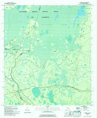
1994 Map of Moniac
USGS Topo · Published 1994About this map
The St Marys River forms a winding natural boundary between Georgia and Florida, anchoring the small settlements of Moniac and Baxter during the mid-1990s. This survey illustrates the intricate relationship between the river’s edge and the southern reaches of the Okefenokee Swamp, where elevated terrain features like Moonshine Ridge and Soldiers Camp Island emerge from the wetland. Notable for local history, the map identifies the Moniac Cem and the specific location of Ellicotts Mound, a historic surveying landmark marking the 1796 boundary line. The landscape is a network of named islands and heads, including Roosting Ear Island and Sally Head, connected by functional routes such as the Perimeter Road and the Wilderness Road that trace the margins of the Okefenokee National Wildlife Refuge and Wilderness.
Find a feature on this map
39 named features on this map. Tap any name to fly to it.
Don’t see what you’re looking for? This feature index may not catch every label — zoom into the map to look around manually.
Map Details
Editions of this 1994 Moniac Map
This is the sole edition of this map. No revisions or reprints were ever made.
Other maps of this area

1917 · Macclenny
USGS Topo · 1:62,500

1918 · Moniac
USGS Topo · 1:62,500

1918 · Macclenny
USGS Topo · 1:62,500

1942 · Moniac
USGS Topo · 1:62,500

1954 · Valdosta
USGS Topo · 1:250,000

1956 · Eddy
USGS Topo · 1:24,000

1958 · Valdosta
USGS Topo · 1:250,000

1959 · Valdosta
USGS Topo · 1:250,000

1965 · Chesser Island
USGS Topo · 1:24,000

1965 · Blackjack Island
USGS Topo · 1:24,000