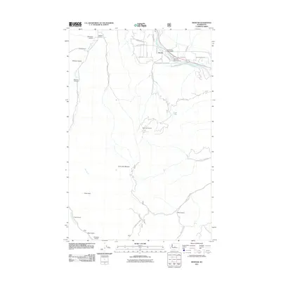
2011 Map of Monitor
USGS Topo · Published 2011About this map
The Wenatchee River winds through the northern reaches of this territory, where the settlement of Monitor serves as a central hub for the surrounding orchards and valleys. This 2011 survey illustrates a landscape deeply defined by its complex drainage systems and canyon networks, including Mission Creek and the Olive Ditch irrigation infrastructure. The transition from the river valley to the high ground is marked by prominent features like Horse Lake Mountain and Sheep Rock, while numerous named canyons such as Yaksum Canyon and Fairview Canyon carve through the terrain. Cultural landmarks like the Old Monitor Road Bridge and the Wenatchee River County Park Campground highlight the area's role in local transportation and recreation. The intricate network of local roads, including Monitor Orchard Rd and Sleepy Hollow Rd, traces the historical development of the agricultural and residential corridors north of the mountains.
Find a feature on this map
42 named features on this map. Tap any name to fly to it.
Don’t see what you’re looking for? This feature index may not catch every label — zoom into the map to look around manually.
Map Details
Editions of this 2011 Monitor Map
This is the sole edition of this map. No revisions or reprints were ever made.
Other maps of this area

1897 · Mount Stuart
USGS Topo · 1:125,000

1901 · Chelan
USGS Topo · 1:125,000

1901 · Chiwaukum
USGS Topo · 1:125,000

1902 · Mount Stuart
USGS Topo · 1:125,000

1904 · Chiwaukum
USGS Topo · 1:125,000

1913 · Wenatchee
USGS Topo · 1:62,500

1915 · Wenatchee
USGS Topo · 1:62,500

1920 · Colockum Pass
USGS Topo · 1:125,000

1922 · Colockum Pass
USGS Topo · 1:125,000

1957 · Wenatchee
USGS Topo · 1:250,000