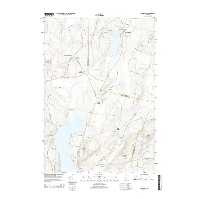
2014 Map of Monmouth
USGS Topo · Published 2014About this map
The Dead River and Jock Stream drain a landscape of low hills and glacial lakes along the border of Androscoggin and Kennebec counties. This 2014 survey documents the enduring layout of rural communities like Wales Corner, Keenes Corner, and Monmouth, where the road network follows historic corridors such as Main St and Richmond Rd. The map is particularly useful for genealogical research, identifying numerous family-named landmarks and burial grounds, including Kimball Cem, Monmouth Center Cem, and Mitchell Cem.
Find a feature on this map
115 named features on this map. Tap any name to fly to it.
Don’t see what you’re looking for? This feature index may not catch every label — zoom into the map to look around manually.
Map Details
Editions of this 2014 Monmouth Map
This is the sole edition of this map. No revisions or reprints were ever made.
Other maps of this area

1892 · Gardiner
USGS Topo · 1:62,500

1892 · Augusta
USGS Topo · 1:62,500

1908 · Lewiston
USGS Topo · 1:62,500

1910 · Livermore
USGS Topo · 1:62,500

1912 · Livermore
USGS Topo · 1:62,500

1941 · Livermore
USGS Topo · 1:62,500

1941 · Augusta
USGS Topo · 1:62,500

1942 · Lewiston
USGS Topo · 1:62,500

1943 · Augusta
USGS Topo · 1:62,500

1943 · Gardiner
USGS Topo · 1:62,500