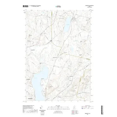
2021 Map of Monmouth
USGS Topo · Published 2021About this map
Cochnewagon Lake and the village of Monmouth define this central Maine landscape, where the town center and Monmouth Center Cem sit between the water and the surrounding highlands of Norris Hill and Sawyer Hill. To the west, the rail-oriented settlement of Leeds Junction reflects the region's historical transport patterns, while Sprague Mill and Wales Corner point to the dispersed industrial and agricultural hamlets that once populated the area. The map reveals a high density of ancestral sites for genealogists, including Keenes Corner Cem, Monmouth Ridge Cem, and Pond Road Cem. Significant terrain features like Sabattus Mtn and Monmouth Ridge contrast with the lowlands around Custer Pond and Maxwell Swamp, showing how the land dictated the placement of roads and homesteads across the county line between Kennebec and Androscoggin.
Find a feature on this map
121 named features on this map. Tap any name to fly to it.
Don’t see what you’re looking for? This feature index may not catch every label — zoom into the map to look around manually.
Map Details
Editions of this 2021 Monmouth Map
This is the sole edition of this map. No revisions or reprints were ever made.
Other maps of this area

1892 · Gardiner
USGS Topo · 1:62,500

1892 · Augusta
USGS Topo · 1:62,500

1908 · Lewiston
USGS Topo · 1:62,500

1910 · Livermore
USGS Topo · 1:62,500

1912 · Livermore
USGS Topo · 1:62,500

1941 · Livermore
USGS Topo · 1:62,500

1941 · Augusta
USGS Topo · 1:62,500

1942 · Lewiston
USGS Topo · 1:62,500

1943 · Augusta
USGS Topo · 1:62,500

1943 · Gardiner
USGS Topo · 1:62,500