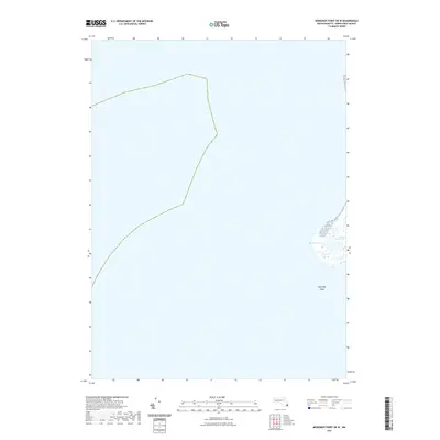
2021 Map of Monomoy Point OE W
USGS Topo · Published 2021About this map
Shovelful Shoal and the shifting coastal waters of Barnstable County define this maritime landscape at the southernmost reaches of the Cape. The map captures a dynamic intersection of land and sea, where the secluded waters of Powder Hole are tucked behind protective dunes. This area, largely defined by its aquatic environment, shows the intricate wetlands of Station Pond Marsh and the open expanse of Big Station Pond. Because the terrain is primarily shaped by tides and shoals rather than permanent roads or settlements, it offers a distinct view of the natural coastal evolution of Massachusetts. The lack of inland development emphasizes the area's role as a navigational waypoint and a significant ecological site within the Atlantic coastal system.
Find a feature on this map
4 named features on this map. Tap any name to fly to it.
Don’t see what you’re looking for? This feature index may not catch every label — zoom into the map to look around manually.
Map Details
Editions of this 2021 Monomoy Point OE W Map
This is the sole edition of this map. No revisions or reprints were ever made.
Other maps of this area

1887 · Yarmouth
USGS Topo · 1:62,500

1888 · Chatham
USGS Topo · 1:62,500

1889 · Yarmouth
USGS Topo · 1:62,500

1893 · Chatham
USGS Topo · 1:62,500

1893 · Yarmouth
USGS Topo · 1:62,500

1917 · Chatham
USGS Topo · 1:62,500

1942 · Cape Cod Bay
USGS Topo · 1:125,000
1942 · Monomoy Point
USGS Topo · 1:31,680
1942 · Chatham
USGS Topo · 1:31,680

1942 · Nauset
USGS Topo · 1:125,000