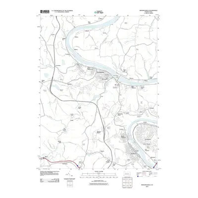
2010 Map of Monongahela
USGS Topo · Published 2010About this map
The Monongahela River carves a deep valley through this industrial and residential landscape south of Pittsburgh, where established river towns like Monongahela and Monessen anchor the region's historical development. The map reveals a dense network of transportation and industry, from the Monongahela City Bridge to the subterranean Temple Tunnel and Vang Tunnel. Small, often family-named settlements like Hazel Kirk, Fisher, and Sampson dot the interior hills away from the river banks. This survey is particularly valuable for genealogists, as it meticulously identifies numerous burial grounds, including Monongahela Cemetery, Horseshoe Bend Cemetery, and Ohar Sholom Cemetery. Along the western edge, the path of Pigeon Creek and its tributaries like Sawmill Creek illustrate the rugged drainage patterns that influenced local rail and road placement, such as the Narrow Gauge Rd.
Find a feature on this map
134 named features on this map. Tap any name to fly to it.
Don’t see what you’re looking for? This feature index may not catch every label — zoom into the map to look around manually.
Map Details
Editions of this 2010 Monongahela Map
This is the sole edition of this map. No revisions or reprints were ever made.
Other maps of this area

1901 · Amity
USGS Topo · 1:62,500

1902 · Brownsville
USGS Topo · 1:62,500

1904 · Amity
USGS Topo · 1:62,500

1904 · Mc Keesport
USGS Topo · 1:62,500

1904 · Carnegie
USGS Topo · 1:62,500

1906 · Brownsville
USGS Topo · 1:62,500

1906 · Carnegie
USGS Topo · 1:62,500

1907 · Pittsburg
USGS Topo · 1:62,500

1908 · Carnegie
USGS Topo · 1:62,500

1931 · Brownsville
USGS Topo · 1:62,500