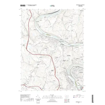
2019 Map of Monongahela
USGS Topo · Published 2019About this map
The Monongahela River carves a deep valley through this landscape, serving as the industrial and geographical spine for a dense corridor of river towns. The 2019 data shows the historic core of Monongahela and New Eagle linked to eastern banks by the Monongahela City Bridge. The region's complex topography is marked by named hollows and hills, including Pangburn Hollow and Black Diamond Hollow, while the infrastructure reflects the area's coal and transit heritage with features like the Vang Tunnel and Temple Tunnel. Numerous cemeteries, such as the Sacred Heart Catholic Cem and Mausoleum and Ohav Sholom Cem, provide significant genealogical landmarks. The presence of the Norfolk Southern line along the river emphasizes the continued importance of the rail-and-water transport network in Washington County.
Find a feature on this map
107 named features on this map. Tap any name to fly to it.
Don’t see what you’re looking for? This feature index may not catch every label — zoom into the map to look around manually.
Map Details
Editions of this 2019 Monongahela Map
This is the sole edition of this map. No revisions or reprints were ever made.
Other maps of this area

1901 · Amity
USGS Topo · 1:62,500

1902 · Brownsville
USGS Topo · 1:62,500

1904 · Amity
USGS Topo · 1:62,500

1904 · Mc Keesport
USGS Topo · 1:62,500

1904 · Carnegie
USGS Topo · 1:62,500

1906 · Brownsville
USGS Topo · 1:62,500

1906 · Carnegie
USGS Topo · 1:62,500

1907 · Pittsburg
USGS Topo · 1:62,500

1908 · Carnegie
USGS Topo · 1:62,500

1931 · Brownsville
USGS Topo · 1:62,500