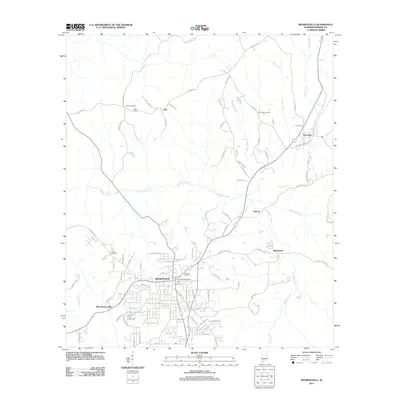
2011 Map of Monroeville
USGS Topo · Published 2011About this map
Monroeville serves as the focal point of this 2011 survey, showing the regional hub's modern layout and its relationship to the surrounding Alabama landscape. The map details the core of the community, from the Monroeville Post Office to the quiet expanse of Hillcrest Cemetery. To the south, Vanity Fair Lake and its accompanying Vanity Fair Lake Dam mark the transition between the developed town center and the more dispersed residential reaches of West Monroeville.
Find a feature on this map
96 named features on this map. Tap any name to fly to it.
Don’t see what you’re looking for? This feature index may not catch every label — zoom into the map to look around manually.
Map Details
Editions of this 2011 Monroeville Map
This is the sole edition of this map. No revisions or reprints were ever made.
Other maps of this area

1953 · Andalusia
USGS Topo · 1:250,000

1957 · Andalusia
USGS Topo · 1:250,000

1967 · Beatrice
USGS Topo · 1:24,000

1971 · Burnt Corn
USGS Topo · 1:24,000

1971 · Repton
USGS Topo · 1:24,000

1971 · Beatrice
USGS Topo · 1:24,000

1972 · Monroeville
USGS Topo · 1:24,000

1972 · Frisco City
USGS Topo · 1:24,000

1972 · Natchez
USGS Topo · 1:24,000

1972 · Franklin
USGS Topo · 1:24,000