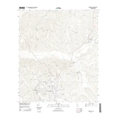
2014 Map of Monroeville
USGS Topo · Published 2014About this map
Monroeville serves as the central hub of this Monroe County landscape, showing the town's modern footprint alongside neighboring communities like West Monroeville and Monroeton. The terrain is defined by a network of waterways including Limestone Creek, Brushy Creek, and Roiley Creek that carve through the Alabama coastal plain. Several family-named landmarks and historical sites are preserved on this survey, including Hillcrest Cemetery and Mars Hill Cemetery. To the north, smaller settlements such as Axle and Peterman are linked by local routes like CR-42 and Longleaf Road. The geography reflects a mix of residential expansion and rural tradition, with Vanity Fair Lake providing a prominent local landmark within the primary settlement area.
Find a feature on this map
100 named features on this map. Tap any name to fly to it.
Don’t see what you’re looking for? This feature index may not catch every label — zoom into the map to look around manually.
Map Details
Editions of this 2014 Monroeville Map
This is the sole edition of this map. No revisions or reprints were ever made.
Other maps of this area

1953 · Andalusia
USGS Topo · 1:250,000

1957 · Andalusia
USGS Topo · 1:250,000

1967 · Beatrice
USGS Topo · 1:24,000

1971 · Burnt Corn
USGS Topo · 1:24,000

1971 · Repton
USGS Topo · 1:24,000

1971 · Beatrice
USGS Topo · 1:24,000

1972 · Monroeville
USGS Topo · 1:24,000

1972 · Frisco City
USGS Topo · 1:24,000

1972 · Natchez
USGS Topo · 1:24,000

1972 · Franklin
USGS Topo · 1:24,000