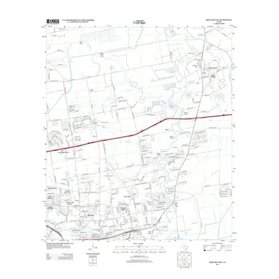
2013 Map of Mont Belvieu
USGS Topo · Published 2013About this map
Mont Belvieu and the surrounding coastal prairies of Chambers and Harris Counties are defined here by a landscape of industrial infrastructure and residential growth. The Barbers Hill Oil Field and Barbers Hill salt dome dominate the northern portion of the map, illustrating the region's long-standing connection to the petroleum industry. This era of development is juxtaposed with older local history preserved in numerous burial grounds, including the First United Methodist Cem of Mont Belvieu, Williams Cem, and Fisher Cem.
Find a feature on this map
48 named features on this map. Tap any name to fly to it.
Don’t see what you’re looking for? This feature index may not catch every label — zoom into the map to look around manually.
Map Details
Editions of this 2013 Mont Belvieu Map
This is the sole edition of this map. No revisions or reprints were ever made.
Other maps of this area

1916 · Burnett Bay
USGS Topo · 1:24,000

1916 · Crosby
USGS Topo · 1:24,000

1916 · Morgan Point
USGS Topo · 1:24,000

1916 · Cedar Bayou
USGS Topo · 1:24,000

1916 · La Porte
USGS Topo · 1:24,000

1919 · Morgan Point
USGS Topo · 1:31,680

1919 · Crosby
USGS Topo · 1:31,680

1919 · Cedar Bayou
USGS Topo · 1:31,680

1920 · La Porte
USGS Topo · 1:31,680

1920 · Highlands
USGS Topo · 1:31,680