
1919 Map of Morgan Point
USGS Topo · Published 1919About this map
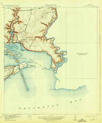
Goose Creek and Morgan Point anchor this coastal landscape during a period of significant maritime and industrial development. This 1919 edition, based on 1916 surveys, shows the coastal geography of the San Jacinto Bay and Galveston Bay junction. The emerging community at Goose Creek is depicted with its early road network, including the Lynchburg and Goose Creek Road and the local Goose Creek School. The maritime importance of the area is evident in the detailed mapping of the Cedar Bayou Ship Channel and the S. P. System railroad line reaching into Bay Ridge. The map also captures several shoreline features and islands, such as Atkinson Island and Spilmans Island, alongside complex water bodies like Ash Lake and Negro Lake near the Harris and Chambers county line.
Find a feature on this map
28 named features on this map. Tap any name to fly to it.
Don’t see what you’re looking for? This feature index may not catch every label — zoom into the map to look around manually.
Map Details
Editions of this 1919 Morgan Point Map
2 editions found
Other maps of this area

1916 · Burnett Bay
USGS Topo · 1:24,000

1916 · Morgan Point
USGS Topo · 1:24,000

1916 · Seabrook
USGS Topo · 1:24,000

1916 · Cedar Bayou
USGS Topo · 1:24,000

1916 · La Porte
USGS Topo · 1:24,000

1919 · Cedar Bayou
USGS Topo · 1:31,680

1920 · Seabrook
USGS Topo · 1:31,680

1920 · La Porte
USGS Topo · 1:31,680

1920 · Highlands
USGS Topo · 1:31,680

1932 · Clifton By The Sea
USGS Topo · 1:31,680