
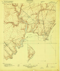
1916 Map of Seabrook
USGS Topo · Published 1916About this map
Seabrook and its surrounding coastal inlets are documented here during a period of transition between the traditional ranching era and the rise of the seaside resort economy. The landscape is defined by the jagged shoreline of Galveston Bay, where Taylor Lake and Clear Lake dominate the terrain. Early infrastructure is anchored by the Southern Pacific System and the Galveston Houston Electric Ry, which provided the vital transport links for the developing fishing and tourist communities. Cultural landmarks like the Old Middle Bayou School and the fishing camp of Killkare offer evidence of the area's rural social life before the suburban expansion of the later century. A Dredged Channel cutting through the center of the lake indicates early maritime engineering efforts to maintain access for vessel traffic between the inland waters and the bay.
Find a feature on this map
25 named features on this map. Tap any name to fly to it.
Don’t see what you’re looking for? This feature index may not catch every label — zoom into the map to look around manually.
Map Details
Editions of this 1916 Seabrook Map
2 editions found
Other maps of this area

1915 · Deepwater
USGS Topo · 1:24,000

1916 · Genoa
USGS Topo · 1:24,000

1916 · Morgan Point
USGS Topo · 1:24,000

1916 · La Porte
USGS Topo · 1:24,000

1919 · Morgan Point
USGS Topo · 1:31,680

1919 · Deepwater
USGS Topo · 1:31,680

1920 · Seabrook
USGS Topo · 1:31,680

1920 · Genoa
USGS Topo · 1:31,680

1920 · La Porte
USGS Topo · 1:31,680

1929 · Dickinson
USGS Topo · 1:24,000