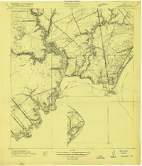
1920 Map of Seabrook
USGS Topo · Published 1920About this map
Seabrook and the surrounding coastal wetlands of Harris County are documented here during a period of burgeoning rail connectivity and bayfront development. The landscape is defined by the complex estuary system where Middle Bayou, Taylor Lake, and Clear Creek converge into Clear Lake before entering Galveston Bay. This 1916 survey highlights early educational and social infrastructure, such as the Old Middle Bayou School and the Clear Lake Inn, alongside the leisure-oriented settlement of Killkare. Significant transportation corridors are well-established, including the Southern Pacific System and the Galveston Houston Electric lines, which supported the movement of people and goods between Houston and the coast. The presence of a Dredged Channel in the lake and a Power Plant to the southwest near Webster points to the early industrial engineering of the Texas shoreline.
Find a feature on this map
37 named features on this map. Tap any name to fly to it.
Don’t see what you’re looking for? This feature index may not catch every label — zoom into the map to look around manually.
Map Details
Editions of this 1920 Seabrook Map
This is the sole edition of this map. No revisions or reprints were ever made.
Historical Maps of Houston Through Time
3 maps found