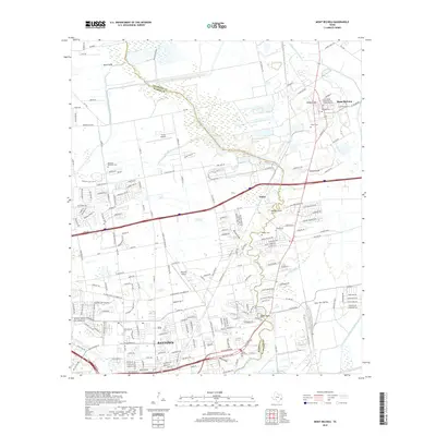
2019 Map of Mont Belvieu
USGS Topo · Published 2019About this map
Cedar Bayou serves as a prominent natural boundary between Chambers and Harris counties, carving a path through a landscape of suburban expansion and coastal prairie. The settlement of Mont Belvieu is situated atop Barbers Hill, a geologic salt dome that has historically influenced the local economy and geography. To the south, the sprawling layout of Baytown is evident, showing the dense network of residential streets and industrial corridors that define this portion of the Texas Gulf Coast.
Find a feature on this map
201 named features on this map. Tap any name to fly to it.
Don’t see what you’re looking for? This feature index may not catch every label — zoom into the map to look around manually.
Map Details
Editions of this 2019 Mont Belvieu Map
This is the sole edition of this map. No revisions or reprints were ever made.
Other maps of this area

1916 · Burnett Bay
USGS Topo · 1:24,000

1916 · Crosby
USGS Topo · 1:24,000

1916 · Morgan Point
USGS Topo · 1:24,000

1916 · Cedar Bayou
USGS Topo · 1:24,000

1916 · La Porte
USGS Topo · 1:24,000

1919 · Morgan Point
USGS Topo · 1:31,680

1919 · Crosby
USGS Topo · 1:31,680

1919 · Cedar Bayou
USGS Topo · 1:31,680

1920 · La Porte
USGS Topo · 1:31,680

1920 · Highlands
USGS Topo · 1:31,680