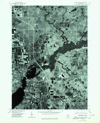
1976 Map of Montague NE
USGS Topo · Published 1979About this map
Montague and Whitehall anchor the southern reaches of this 1976 orthophotoquad, where the urban street grid meets the widening waters of the White River. This aerial perspective captures the region during a period of established residential growth, showing the distinct neighborhood patterns of Maple Grove and the development at Lakewood. The high-altitude imagery emphasizes the transition from the dense township centers to the northern agricultural plots and wooded tracts. By documenting the land use just before the late 1970s, the map provides a clear view of the transportation corridors and industrial footprints that shaped these lakeside communities. The winding course of the White River dominates the central landscape, serving as a natural boundary and a focal point for the surrounding settlements.
Find a feature on this map
5 named features on this map. Tap any name to fly to it.
Don’t see what you’re looking for? This feature index may not catch every label — zoom into the map to look around manually.
Map Details
Editions of this 1976 Montague NE Map
This is the sole edition of this map. No revisions or reprints were ever made.
Other maps of this area

1929 · Montague
USGS Topo · 1:48,000

1931 · Hart SE
USGS Topo · 1:31,680

1931 · Walkerville SW
USGS Topo · 1:31,680

1954 · Milwaukee
USGS Topo · 1:250,000

1958 · Milwaukee
USGS Topo · 1:250,000

1958 · Hesperia
USGS Topo · 1:62,500

1958 · Twin Lake
USGS Topo · 1:62,500

1959 · Montague
USGS Topo · 1:62,500

1959 · Hart
USGS Topo · 1:62,500

1976 · Montague NW
USGS Topo · 1:24,000