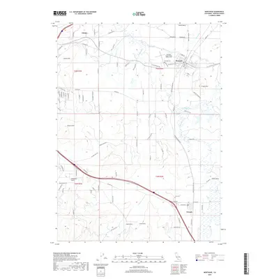
2018 Map of Montague
USGS Topo · Published 2018About this map
The Shasta River and Little Shasta River converge in this northern California corridor, defining the agricultural and transit patterns of the Shasta Valley. The landscape is anchored by the historic rail and ranching hubs of Montague and Grenada, while the eastern edge of Yreka provides a window into the regional seat's growth. The terrain is marked by distinctive volcanic and alluvial features, including Butcher Hill and the Kilgore Hills, which rise above the surrounding flats.
Find a feature on this map
100 named features on this map. Tap any name to fly to it.
Don’t see what you’re looking for? This feature index may not catch every label — zoom into the map to look around manually.
Map Details
Editions of this 2018 Montague Map
This is the sole edition of this map. No revisions or reprints were ever made.
Other maps of this area

1886 · Shasta
USGS Topo · 1:250,000

1894 · Shasta
USGS Topo · 1:250,000

1921 · Shasta Valley Sheet No 6
USGS Topo · 1:24,000

1921 · Shasta Valley Sheet No 2
USGS Topo · 1:24,000

1922 · Shasta Valley Sheet No 4
USGS Topo · 1:24,000

1922 · Shasta Valley Sheet No 3
USGS Topo · 1:24,000

1922 · Shasta Valley Sheet No 3 S
USGS Topo · 1:24,000

1922 · Shasta Valley Sheet No 5
USGS Topo · 1:24,000

1932 · Yreka
USGS Topo · 1:96,000

1934 · Macdoel
USGS Topo · 1:96,000