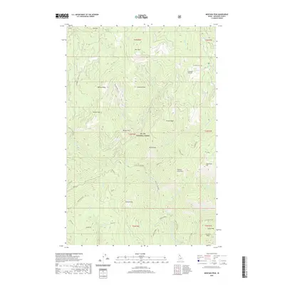
2020 Map of Montana Peak
USGS Topo · Published 2020About this map
St. Joe National Forest encompasses this high-elevation Idaho landscape, defined by a series of prominent peaks and the deep drainage of the Little N Fk Clearwater River. The terrain is marked by significant crests including Montana Peak and Snow Peak, which anchor a complex network of ridges such as Hoodoo Ridge and Surveyors Ridge. This 2020 survey illustrates the contemporary management of these wild lands, where recreation and forest access are facilitated by designated routes like Montana Creek Rd and the Buzzard Roost Rd.
Find a feature on this map
52 named features on this map. Tap any name to fly to it.
Don’t see what you’re looking for? This feature index may not catch every label — zoom into the map to look around manually.
Map Details
Editions of this 2020 Montana Peak Map
This is the sole edition of this map. No revisions or reprints were ever made.
Other maps of this area

1914 · Avery
USGS Topo · 1:125,000

1917 · Avery
USGS Topo · 1:125,000

1923 · Washington Creek
USGS Topo · 1:125,000

1936 · Boehls Butte
USGS Topo · 1:48,000

1943 · Boehls Butte
USGS Topo · 1:62,500

1956 · Wallace
USGS Topo · 1:250,000

1956 · Hamilton
USGS Topo · 1:250,000

1959 · Hamilton
USGS Topo · 1:250,000

1960 · Wallace
USGS Topo · 1:250,000

1960 · Hamilton
USGS Topo · 1:250,000