
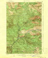
1943 Map of Boehls Butte
USGS Topo · Published 1943About this map
Boehls sits at the confluence of several mountain drainages in the heart of the Bitterroot Mountains, serving as a focal point for this 1936 survey of the Idaho backcountry. The landscape is defined by the winding course of the North Fork Clearwater River and the Little North Fork Clearwater River, which carve deep valleys through the heavily forested terrain of the St Joe National Forest and Clearwater National Forest.
Find a feature on this map
46 named features on this map. Tap any name to fly to it.
Don’t see what you’re looking for? This feature index may not catch every label — zoom into the map to look around manually.
Map Details
Editions of this 1943 Boehls Butte Map
2 editions found
Other maps of this area

1914 · Avery
USGS Topo · 1:125,000

1917 · Avery
USGS Topo · 1:125,000

1923 · Washington Creek
USGS Topo · 1:125,000

1936 · Boehls Butte
USGS Topo · 1:48,000

1938 · Headquarters
USGS Topo · 1:48,000

1944 · Headquarters
USGS Topo · 1:62,500

1955 · Pullman
USGS Topo · 1:250,000

1955 · Spokane
USGS Topo · 1:250,000

1956 · Wallace
USGS Topo · 1:250,000

1956 · Hamilton
USGS Topo · 1:250,000