
1938 Map of Headquarters
USGS Topo · Published 1938About this map
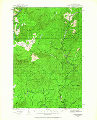
The timber-rich landscape of Clearwater National Forest dominates this 1938 survey, centered on the logging and management hub of Headquarters. The map captures a moment when resource extraction and fire prevention infrastructure were paramount, exemplified by the Clearwater Fire Protective Association Headquarters and high-elevation watchpoints like Summit Lookout and Shanghai Lookout. The industrial character of the era is evident in the string of railroad sidings such as Murphy Siding and Reveling Siding, which serviced the rugged drainage basins of the North Fork Clearwater River.
Find a feature on this map
55 named features on this map. Tap any name to fly to it.
Don’t see what you’re looking for? This feature index may not catch every label — zoom into the map to look around manually.
Map Details
Editions of this 1938 Headquarters Map
2 editions found
Other maps of this area

1923 · Washington Creek
USGS Topo · 1:125,000

1924 · Kamiah
USGS Topo · 1:125,000

1924 · Weippe
USGS Topo · 1:125,000

1936 · Boehls Butte
USGS Topo · 1:48,000

1943 · Boehls Butte
USGS Topo · 1:62,500

1944 · Headquarters
USGS Topo · 1:62,500

1955 · Pullman
USGS Topo · 1:250,000

1956 · Hamilton
USGS Topo · 1:250,000

1958 · Pullman
USGS Topo · 1:250,000

1959 · Hamilton
USGS Topo · 1:250,000