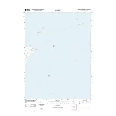
2013 Map of Montauk Point OE E
USGS Topo · Published 2013About this map
Montauk Point stands at the extreme eastern tip of Long Island, where the land meets the vast expanse of the Atlantic Ocean. This maritime-focused survey highlights the transition from the rocky shoreline of the South Fork to the hazardous underwater topography that has long challenged navigators. Coastal features like False Point and the small freshwater Money Pond are documented alongside significant undersea landmarks, including Endeavor Shoals, Phelps Ledge, and Great Eastern Rock. The map illustrates the region's continued reliance on maritime transit, specifically marking the route of the Block Island - Montauk Ferry. On land, the corridor of the Old Montauk Hwy provides the primary access to this iconic point, while the offshore Montauk Shoal indicates the shallow, shifting depths that define the waters surrounding the tip.
Find a feature on this map
10 named features on this map. Tap any name to fly to it.
Don’t see what you’re looking for? This feature index may not catch every label — zoom into the map to look around manually.
Map Details
Editions of this 2013 Montauk Point OE E Map
This is the sole edition of this map. No revisions or reprints were ever made.
Other maps of this area

1889 · Block Island
USGS Topo · 1:62,500

1894 · Block Island
USGS Topo · 1:62,500

1899 · Block Island
USGS Topo · 1:62,500

1904 · Montauk
USGS Topo · 1:62,500
1942 · Montauk Point
USGS Topo · 1:24,000

1942 · Block Island
USGS Topo · 1:125,000

1947 · Providence
USGS Topo · 1:250,000

1948 · Providence
USGS Topo · 1:250,000
1956 · Montauk Point
USGS Topo · 1:24,000

1957 · Providence
USGS Topo · 1:250,000