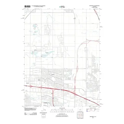
2010 Map of Montbello
USGS Topo · Published 2010About this map
Montbello and the sprawling residential developments of northeast Denver define this 2010 landscape, situated at a critical juncture of urban expansion and specialized land use. To the north, a complex of water management infrastructure includes Upper Derby Lake and several numbered reservoirs such as Reservoir F and Reservoir B, reflecting the region's managed hydrology near the Rocky Mountain Speedway. The map documents the era's significant transit corridors, most notably the path of Pena Blvd leading toward the airport, and the dense suburban grid south of E 56th Ave.
Find a feature on this map
57 named features on this map. Tap any name to fly to it.
Don’t see what you’re looking for? This feature index may not catch every label — zoom into the map to look around manually.
Map Details
Editions of this 2010 Montbello Map
This is the sole edition of this map. No revisions or reprints were ever made.
Other maps of this area

1890 · East Denver
USGS Topo · 1:125,000

1935 · East Denver Nos. 3 and 4
USGS Topo · 1:48,000

1938 · Derby
USGS Topo · 1:24,000

1938 · Long Branch
USGS Topo · 1:24,000

1939 · Coal Creek
USGS Topo · 1:24,000

1940 · Brighton
USGS Topo · 1:31,680

1940 · Englewood
USGS Topo · 1:31,680

1940 · Eastlake
USGS Topo · 1:31,680

1940 · Derby
USGS Topo · 1:31,680

1941 · Long Branch
USGS Topo · 1:31,680