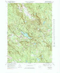
1973 Map of Monterey
USGS Topo · Published 1985About this map
Monterey and its surrounding hill towns appear here during a period of mid-century stabilization, showing a landscape where heavy forestation has reclaimed much of the earlier colonial farmland. The village of Monterey sits near the shores of Lake Garfield, while the Appalachian Trail winds through the high ridges of the Beartown State Forest in the northwest. This topography, dominated by the Konkapot River and Clam River drainage basins, illustrates the transition from a traditional water-powered agricultural economy to one focused on recreation and conservation.
Find a feature on this map
63 named features on this map. Tap any name to fly to it.
Don’t see what you’re looking for? This feature index may not catch every label — zoom into the map to look around manually.
Map Details
Editions of this 1973 Monterey Map
3 editions found
Other maps of this area

1885 · Sheffield
USGS Topo · 1:62,500

1886 · Becket
USGS Topo · 1:62,500

1888 · Sheffield
USGS Topo · 1:62,500

1888 · Becket
USGS Topo · 1:62,500

1888 · Sandisfield
USGS Topo · 1:62,500

1888 · Pittsfield
USGS Topo · 1:62,500

1890 · Pittsfield
USGS Topo · 1:62,500

1891 · Sheffield
USGS Topo · 1:62,500

1893 · Becket
USGS Topo · 1:62,500

1893 · Sheffield
USGS Topo · 1:62,500