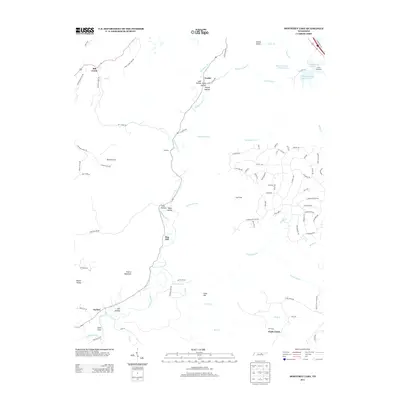
2013 Map of Monterey Lake
USGS Topo · Published 2013About this map
Calfkiller River winds through this section of Putnam County, carving a path through a series of significant hollows and coves. The landscape is defined by its dramatic relief, from the heights of France Mountain and Dug Hill down to the sheltered basins of England Cove, Davidson Cove, and Round Cove. Small settlements like Mill Creek, Verble, and Taylors are connected by a network of rural roads that follow the natural topography of the river valley. In the northeast, the recreational and residential character of the region is evident at Monterey Lake and the nearby Camp Monterey. The map reveals a transition from traditional agricultural lands near Glade Creek to more modern residential development around the lake, including streets like Saw Mill Rd and Tanner Dr.
Find a feature on this map
96 named features on this map. Tap any name to fly to it.
Don’t see what you’re looking for? This feature index may not catch every label — zoom into the map to look around manually.
Map Details
Editions of this 2013 Monterey Lake Map
This is the sole edition of this map. No revisions or reprints were ever made.
Other maps of this area

1892 · Pikeville
USGS Topo · 1:125,000

1895 · Pikeville
USGS Topo · 1:125,000

1897 · Standingstone
USGS Topo · 1:125,000

1898 · Standingstone
USGS Topo · 1:125,000

1912 · Crossville
USGS Topo · 1:62,500

1935 · Campbell Junction
USGS Topo · 1:24,000

1943 · Cookeville
USGS Topo · 1:100,000

1944 · Cookeville
USGS Topo · 1:100,000

1946 · Campbell Junction
USGS Topo · 1:24,000

1946 · Obey City
USGS Topo · 1:24,000