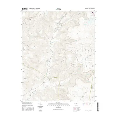
2016 Map of Monterey Lake
USGS Topo · Published 2016About this map
The Calfkiller River carves a deep path through this portion of the Cumberland Plateau, where the town of Monterey sits at the northern edge. The topography is defined by dramatic elevation changes, moving from the heights of France Mtn down into expansive recessed features like England Cove, Davidson Cove, and Round Cove. These coves historically provided sheltered areas for homesteading and agriculture away from the wind-swept ridges. Small rural settlements like Taylors and Board Valley are documented alongside numerous family burial sites, including the Henry Cem, Crouse Cem, and France Cem. Water management is prominent in the northeast, where Monterey Lake Number One and Monterey Lake Number Two collect the flow of Whetstone Cr and Stamps Hollow Cr.
Find a feature on this map
89 named features on this map. Tap any name to fly to it.
Don’t see what you’re looking for? This feature index may not catch every label — zoom into the map to look around manually.
Map Details
Editions of this 2016 Monterey Lake Map
This is the sole edition of this map. No revisions or reprints were ever made.
Other maps of this area

1892 · Pikeville
USGS Topo · 1:125,000

1895 · Pikeville
USGS Topo · 1:125,000

1897 · Standingstone
USGS Topo · 1:125,000

1898 · Standingstone
USGS Topo · 1:125,000

1912 · Crossville
USGS Topo · 1:62,500

1935 · Campbell Junction
USGS Topo · 1:24,000

1943 · Cookeville
USGS Topo · 1:100,000

1944 · Cookeville
USGS Topo · 1:100,000

1946 · Campbell Junction
USGS Topo · 1:24,000

1946 · Obey City
USGS Topo · 1:24,000