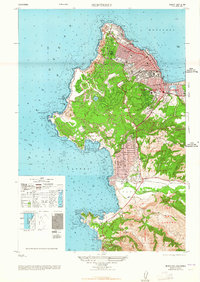
1948 Map of Monterey
USGS Topo · Published 1948About this map
The Presidio of Monterey and the bustling grid of Monterey anchor the northern coastline of this 1948 survey, showing the Monterey Peninsula just after World War II. The landscape is defined by the winding Seventeen Mile Drive, which skirts the rocky shoreline from Spanish Bay past Point Joe to the famous fairways of Cypress Point Golf Course. To the south, the village of Carmel By The Sea sits tucked against Carmel Bay, with the historic San Carlos Borromeo Mission and nearby Mission Ranch marking the transition into the Carmel River valley.
Find a feature on this map
95 named features on this map. Tap any name to fly to it.
Don’t see what you’re looking for? This feature index may not catch every label — zoom into the map to look around manually.
Map Details
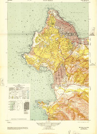
Editions of this 1948 Monterey Map
2 editions found
Other maps of this area

1913 · Monterey
USGS Topo · 1:62,500

1918 · Point Sur
USGS Topo · 1:62,500

1925 · Point Sur
USGS Topo · 1:62,500

1941 · Monterey
USGS Topo · 1:62,500

1947 · Point Sur
USGS Topo · 1:62,500

1947 · Seaside
USGS Topo · 1:24,000

1947 · Monterey
USGS Topo · 1:62,500
1947 · Marina
USGS Topo · 1:24,000

1947 · Monterey
USGS Topo · 1:24,000

1948 · Santa Cruz
USGS Topo · 1:250,000