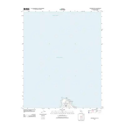
2012 Map of Monterey OE N
USGS Topo · Published 2012About this map
Point Pinos and the surrounding coastline of the Monterey Peninsula dominate the lower portion of this 2012 survey, where the land meets the vast Pacific Ocean. This specific quadrangle captures the northern tip of the peninsula, centered on the residential enclave of Pacific Grove Acres. The landscape is a mix of community landmarks and coastal terrain, including the Pacific Grove Municipal Golf Links and the El Carmelo Cem. Following the shoreline along Sunset Dr, the map details prominent coastal features such as Lovers Point, Lucas Point, and the offshore Aumentos Rock. This contemporary record shows how established neighborhoods and preserved coastal corridors remained defined by their proximity to the water.
Find a feature on this map
9 named features on this map. Tap any name to fly to it.
Don’t see what you’re looking for? This feature index may not catch every label — zoom into the map to look around manually.
Map Details
Editions of this 2012 Monterey OE N Map
This is the sole edition of this map. No revisions or reprints were ever made.
Other maps of this area

1912 · Capitola
USGS Topo · 1:62,500

1913 · Monterey
USGS Topo · 1:62,500

1914 · Capitola
USGS Topo · 1:62,500

1940 · Capitola
USGS Topo · 1:62,500

1941 · Monterey
USGS Topo · 1:62,500

1947 · Seaside
USGS Topo · 1:24,000

1947 · Monterey
USGS Topo · 1:62,500
1947 · Marina
USGS Topo · 1:24,000

1947 · Monterey
USGS Topo · 1:24,000

1948 · Santa Cruz
USGS Topo · 1:250,000