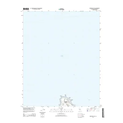
2015 Map of Monterey OE N
USGS Topo · Published 2015About this map
Point Pinos and the northwestern edge of Pacific Grove occupy the southernmost portion of this coastal survey, where the land meets the vast Pacific Ocean and the entrance to Monterey Bay. This maritime landscape is defined by its rocky shoreline and strategic position, featuring landmarks such as Lucas Point and Aumentos Rock. Inland, the map details the suburban grid of the Monterey Peninsula as it appeared in 2015, showing the layout of residential streets like Lighthouse Ave, Asilomar Ave, and Crocker Ave. The presence of Crespi Pond near the tip of the peninsula illustrates the coastal ecology of the area, providing a record of the shoreline before further modern development or environmental changes might alter these specific coastal features.
Find a feature on this map
16 named features on this map. Tap any name to fly to it.
Don’t see what you’re looking for? This feature index may not catch every label — zoom into the map to look around manually.
Map Details
Editions of this 2015 Monterey OE N Map
This is the sole edition of this map. No revisions or reprints were ever made.
Other maps of this area

1912 · Capitola
USGS Topo · 1:62,500

1913 · Monterey
USGS Topo · 1:62,500

1914 · Capitola
USGS Topo · 1:62,500

1940 · Capitola
USGS Topo · 1:62,500

1941 · Monterey
USGS Topo · 1:62,500

1947 · Seaside
USGS Topo · 1:24,000

1947 · Monterey
USGS Topo · 1:62,500
1947 · Marina
USGS Topo · 1:24,000

1947 · Monterey
USGS Topo · 1:24,000

1948 · Santa Cruz
USGS Topo · 1:250,000