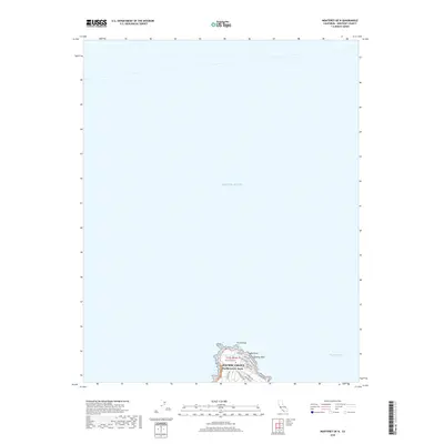
2018 Map of Monterey OE N
USGS Topo · Published 2018About this map
Point Pinos and the residential clusters at the northern tip of the Monterey Peninsula dominate this coastal study. Much of the map covers the vast expanse of the Pacific Ocean and Monterey Bay, but the terrestrial portion is concentrated on the developed community of Pacific Grove. The street grid is clearly defined, reaching out toward the coast along Lighthouse Ave and Sunset Dr. Local landmarks such as Crespi Pond and El Carmelo Cem are positioned near the shoreline, which is punctuated by rocky features like Lucas Point and Aumentos Rock. This contemporary survey highlights the established urban pattern of Pacific Grove Acres, showing the intersection of suburban development and the rugged California coastline.
Find a feature on this map
22 named features on this map. Tap any name to fly to it.
Don’t see what you’re looking for? This feature index may not catch every label — zoom into the map to look around manually.
Map Details
Editions of this 2018 Monterey OE N Map
This is the sole edition of this map. No revisions or reprints were ever made.
Other maps of this area

1912 · Capitola
USGS Topo · 1:62,500

1913 · Monterey
USGS Topo · 1:62,500

1914 · Capitola
USGS Topo · 1:62,500

1940 · Capitola
USGS Topo · 1:62,500

1941 · Monterey
USGS Topo · 1:62,500

1947 · Seaside
USGS Topo · 1:24,000

1947 · Monterey
USGS Topo · 1:62,500
1947 · Marina
USGS Topo · 1:24,000

1947 · Monterey
USGS Topo · 1:24,000

1948 · Santa Cruz
USGS Topo · 1:250,000