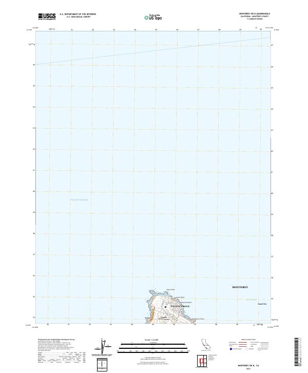
2021 Map of Monterey OE N
USGS Topo · Published 2021About this map
Point Pinos and the rocky protrusions of the Monterey Peninsula dominate the coastline of this coastal California survey. While the vast majority of the map depicts the open Pacific Ocean and the southern reaches of Monterey Bay, the southern edge captures the residential density and coastal orientation of Pacific Grove. The layout of streets like Asilomar Blvd and Jewell Ave follows the curvature of the shore, leading toward landmarks such as Lovers Point and Aumentos Rock. Inland, the El Carmelo Cem sits among the residential tracts of Pacific Grove Acres. Across the bay to the east, the industrial and commercial character of Sand City begins to emerge along Del Monte Blvd, highlighting the distinct separation between the resort-like tip of the peninsula and the mainland coast.
Find a feature on this map
20 named features on this map. Tap any name to fly to it.
Don’t see what you’re looking for? This feature index may not catch every label — zoom into the map to look around manually.
Map Details
Editions of this 2021 Monterey OE N Map
This is the sole edition of this map. No revisions or reprints were ever made.
Other maps of this area

1912 · Capitola
USGS Topo · 1:62,500

1913 · Monterey
USGS Topo · 1:62,500

1914 · Capitola
USGS Topo · 1:62,500

1940 · Capitola
USGS Topo · 1:62,500

1941 · Monterey
USGS Topo · 1:62,500

1947 · Seaside
USGS Topo · 1:24,000

1947 · Monterey
USGS Topo · 1:62,500
1947 · Marina
USGS Topo · 1:24,000

1947 · Monterey
USGS Topo · 1:24,000

1948 · Santa Cruz
USGS Topo · 1:250,000