
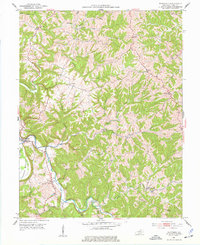
1953 Map of Monterey
USGS Topo · Published 1987About this map
The settlement of Monterey sits along the winding course of Cedar Creek in Owen County, where the Kentucky landscape is defined by deep stream valleys and narrow ridges. This 1950s topography, updated in the late 1980s, reveals a rural network of small communities and family landmarks. Rural life is anchored by several country churches, including Old Cedar Ch, El Bethel Ch, and Richland Ch, many with adjacent burial grounds like the Perkins Cem.
Find a feature on this map
40 named features on this map. Tap any name to fly to it.
Don’t see what you’re looking for? This feature index may not catch every label — zoom into the map to look around manually.
Map Details
Editions of this 1953 Monterey Map
3 editions found
Other maps of this area

1906 · Lockport
USGS Topo · 1:48,000

1908 · Lockport
USGS Topo · 1:62,500

1939 · Sadieville
USGS Topo · 1:62,500

1950 · New Liberty
USGS Topo · 1:24,000

1950 · Owenton
USGS Topo · 1:24,000

1950 · Lawrenceville
USGS Topo · 1:24,000

1953 · Monterey
USGS Topo · 1:24,000

1953 · Gratz
USGS Topo · 1:24,000

1953 · Polsgrove
USGS Topo · 1:24,000
1953 · Stamping Ground
USGS Topo · 1:24,000